
2.1.8 Radar
Probably not relevant for Palau at this point.
Radar is a specialised monitoring technique that can be particularly useful for monitoring nocturnal seabirds, although it can also be used for diurnal species. Radar units transmit high frequency radio waves, which bounce off objects they encounter and return to the antennae – the time this takes is used to calculate the distance to the object. This allows radar units to collect location and velocity (by tracking the object’s location between each radar pulse) of objects within scanning range. For seabird monitoring this is particularly useful for locating nocturnal seabirds transiting into breeding colonies, as radar units can scan a large area (several kilometres) for ‘targets’ which may be identified to species if local species differ in at least one of the following: target speed, time of movement and movement patterns (such as flyways or circling over colonies).
Equipment
There are several types of radar units that are utilised for seabird research, either at sea or on land. These are typically small marine radar units that are mounted on vehicles (either on the top of a boat or truck, or in a truck bed). There are also much larger units that on land can be towed behind a vehicle and have their own free-standing system – some of these are even automated to record targets passing through the radar. Radar can be used horizontally to count birds passing across the study area or vertically to obtain a count of birds passing over a fixed point and calculate vertical height, and some units can do both at the same time.
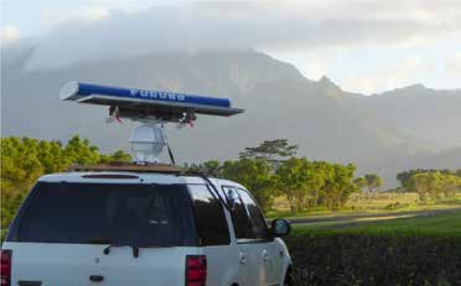
Figure 42. Radar unit mounted on a truck, being used to survey endangered seabirds on Kaua’i. Photo: Stephen Rossiter.
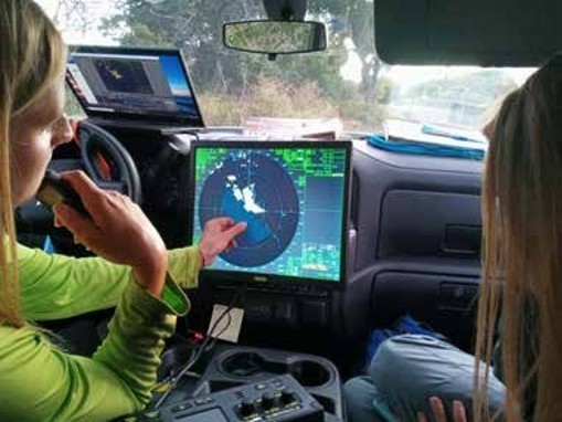
Figure 43. Viewing bird movements on screen in truck cab. Photo: Stephen Rossiter.
Uses
Some of the main uses of radar in seabird studies are (i) counting birds passing over a fixed area, (ii) locating transit routes on land for nocturnal seabirds heading into or leaving colonies, (iii) locating breeding colonies and (iii) charting long term population trends.
- Counting birds. Radar units deployed at fixed sites (either at sea or on land) can be used to count targets passing through the scanning area. This provides standardised counts, with targets identified to species as outlined above.
- Transit routes. By conducting radar surveys during peak transit periods at multiple locations along the coast, radar can help identify important flyways and transit routes for seabirds heading inland from the sea. If attempting to understand local maximum numbers, understanding what time of night constitutes peak transit activity is critical to using this technique as you do not want to conduct radar surveys outside of peak transit periods as this could yield artificially repressed numbers. Similarly, if you are comparing data from multiple locations, make sure that you are conducting surveys at the same time of day or night at each location and the same time of year.
- Colony location. Identifying transit routes via radar can then help direct search effort to locate unknown breeding colonies. By identifying main transit routes and comparing this with potential breeding habitat inland, this will help narrow searches. Alternatively, radar can be deployed at locations on the coast or inland in an attempt to locate concentrations of circling targets that might suggest breeding activity. Again, timing is important, as some species may only be active at colonies during certain periods of the day or night, and this may differ between target species. Furthermore, be aware that radar will not pick up targets flying at a low height (under the radar), so positioning a radar unit above a valley where birds may be breeding will not provide useful data. This will also limit its usefulness for certain research topics, such as assessing powerline collision risk or light attraction studies.
- Assessing long-term population trends. As radar represents a standardised way to count targets, conducting radar surveys in the same location(s) at the same time for multiple years can be used as a way of measuring long-term population trends. This does, however, rely on the survey site itself remaining unchanged between years – if buildings are built adjacent to the survey site between survey years or trees grow tall enough, they can block portions of the radar survey area (or conversely if trees are removed more lower flying birds may be detected), this will artificially reduce target counts as it will reduce effective survey area.
Considerations
Radar can be very useful for surveying large areas and assessing seabird movement. A firm understanding of species movement patterns, speeds and behaviours is critical for identifying targets on the radar to species. Conversely, while radar can be very useful in helping to answer important research questions, it is a highly specialised technique and requires expensive equipment that needs to be operated by trained technicians. This can often preclude its use from studies, especially when there are cheaper and easier survey options available. Lastly, it is important to understand the limitations of radar, as in certain environments and at certain angles to birds there is a risk that birds are passing through an area and are being entirely missed by radar (particularly true for low-flying birds). An example of this would be a study using radar to count birds passing through power lines – if the radar is positioned in such a way that it misses low-flying birds at power line height, then it would be useless at assessing power line collision risk.